The Government of Nepal, through a Nepal Gazette notice dated July 19, 2010 (Section 60, Number 14, Part 5, 2067/04/03 B.S.), has entrusted the management responsibility of Gaurishankar Conservation Area to the National Trust for Nature Conservation (NTNC) for 20 years. Gaurishankar Conservation Area (GCA) was declared by the Government of Nepal, through a Nepal Gazette notice on January 11, 2010 (Section 59, Number 38, Part 5, 2066/09/27 B.S.). It is the third Conservation Area entrusted by the Government of Nepal to NTNC for management. Annapurna Conservation Area and Manaslu Conservation Area are already under NTNC management.
With outstanding biodiversity that also serves as a biological corridor connecting two crucial protected areas of the country, Sagarmatha National Park and Langtang National Park, GCA covers an area of 2,179 sq.km encompassing 2 municipalities and 8 Rural Municipalities (RM) of three districts, Sindhupalchok, Dolakha and Ramechhap of Province No 3 of the country. Full of natural, cultural, and historical significance, GCA, due to the presence of elongated altitudinal gradient is not only rich in biodiversity but is also a mosaic of Hindu and Buddhist cultures. Tamang is the largest ethnic group followed by Sherpa and Chhetri. Other ethnic groups in the region include Newar, Thangmi, Gurung, Brahman, Jirel, Kami, Damai and Sarki.
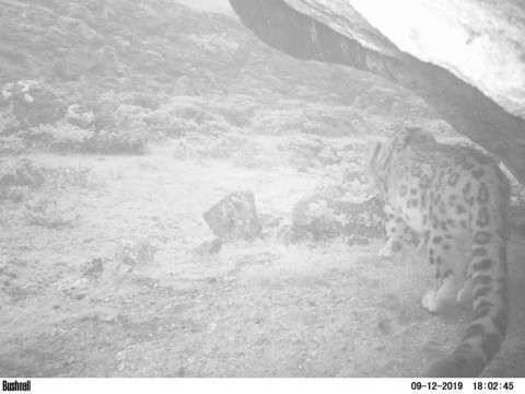
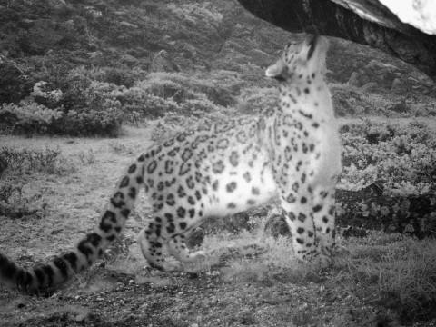
GCA comprises of 16 major vegetation types: Pinus roxburghii forest, Schima-Castanopsis forest, Alnus forest, Pinus wallichiana forest, Pinus patula forest, Rhododendron forest, Quercus lanata forest, Lower temperate oak forest (Quercus semicarpifolia forest), Lower temperate mixed broad leaved forest, Abies forest, Upper temperate mixed forest (Birch-rhododendron forest), Temperate mountain oak forest, East Himalayan Oak forest, Juniperus forest, Shrubland (Rhododendron anthopogon bushes) and Moist alpine scrubs. Forest and bushes cover 44.5%, while cultivation land is 8.8%, grasslands is 8.6%, glaciers 2.77% and barren land and others make up the rest of the total area. The area harbors 565 species of plants, 77 species of mammals, 16 species of fishes, 9 species of amphibians, 22 species of reptiles and 235 species of birds.
The region is quite rich in water resources and is a catchment of Khimti, Bhotekoshi, Sunkoshi, and Tamakoshi rivers which are the main source of water for some major hydro-power projects in the country. The region is also famous for glacial lakes, particularly the Tso Rolpa which came into limelight with the possibility of its bursting. With the issue of climate change becoming prominent in the national and international arena, the region carries special significance. Currently, GCAP takes sole responsibility of natural resource management focusing especially on forest management, non-timber forest products regulation, tourism promotion and curbing illegal wildlife crimes. Together with conservation focused activities, it also undertakes small to medium scaled community development works and promotion of alternative energy sources, which help benefit forest users, conservation farmers and the local community at large.